Oregon's own standards say this river reach is supposed to do a lot more than host an industrial dock
Oregon DEQ's Table 101A lists the mainstem Columbia here as designated for public domestic water supply, private domestic water supply, industrial water supply, irrigation, livestock watering, fish and aquatic life, wildlife and hunting, fishing, boating, water contact recreation, aesthetic quality, and commercial navigation and transportation.
The legal framework treats the river reach as a multi-use water system, not a one-purpose industrial corridor.
The local site itself is tied into farm water infrastructure
NOAA says the project area includes about 10,000 linear feet of waterways operated by the Beaver Drainage Improvement Company. Those waterways drain floodwater and also supply irrigation water to farms through McLean Slough and Beaver Slough.
NOAA's record places farm drainage and irrigation infrastructure inside the local project geography.
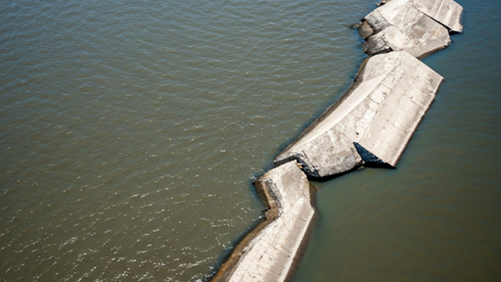
The state is already treating the receiving waters as stressed
DEQ's 401 certification says the project is in wetlands and waters that discharge to McLean Slough, a tributary to the Clatskanie River. DEQ also says the Clatskanie is impaired for dissolved oxygen, and the relevant Columbia reach is limited or impaired for temperature, dioxin, total dissolved gas, PCBs, and DDE.
The downstream review is being layered onto waters DEQ already identifies as impaired or limited.
Downstream cities and ports carry the intake risk
Oregon designates the reach for public domestic water supply, industrial water supply, and commercial navigation and transportation.
USACE says the project would move feedstocks and fuel through the existing Port of Columbia dock and could involve up to 171 ocean-going vessel movements a year, in addition to rail and truck traffic.
The permit file stacks multiple designated uses in one river reach
Drinking water, industrial use, irrigation, livestock watering, fish habitat, boating, and commercial navigation all sit in the same designated-use record before the NEXT proposal adds vessel traffic, rail movement, stormwater controls, and industrial handling.
The permit record therefore has to carry more than facility engineering; it also has to account for the surrounding river uses already written into Oregon's standards.
Farms, ranches, and processors sit in the same water path
The official record ties the site to irrigation-support waterways, livestock-watering uses, fish habitat, and water-quality standards meant to protect domestic supply and agricultural use.
A project inside a floodplain water system that serves farms and carries irrigation and livestock-use designations is also a rural-economy review, even when the applicant markets the facility as an energy project.